What do you want to see?
Beach · Baška south-east coves
Vela Luka, Baška
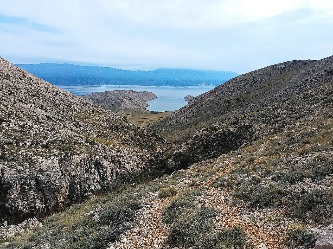
A deep bay at the end of a bare karst valley south-east of Baška, open to the south, with a pebble beach, sheep, a seasonal konoba known for grilled squid, and a few rental umbrellas. Most people come by a 15-minute taxi boat from Baška harbour; the alternative is a 2–2.5 h hike over the hill (about 6 km, 300 m up and down) with no shade.
Our tips
- Taxi boats leave from near the main pier in Baška, about EUR 20–22 per person return (2025); agree your pickup time with the skipper.
- Arrive early and take the shade under the cave on the left side of the bay, or in the two side coves.
- Try the konoba's grilled squid.
- Walk 20 min on to Mala Luka for a quieter swim.
- Hike it in spring or autumn, not in midsummer heat.
- Hike out early and take the taxi boat back.
Good to know
- Water can be very cold in August.
- Umbrella + loungers EUR 30; burgers EUR 15 (2026).
- In August, private umbrellas and tents can ring the rental area by midday.
- The hike is hot and exposed.
The details
- Where
- Baška (south-east coast)
- Season
- Konoba and rentals in summer
- Best time
- Arrive by 10:00 (Jun–Sep); hike in Apr–May or Sep–Oct
- Getting there
- Taxi boat from Baška (15 min) or trail no. 9 from Camp Bunculuka (about 2–2.5 h, rough, no flip-flops).
- Good for
- couples, families, foodies, snorkelling, groups
- Village guide
- Baška south-east coves: Bunculuka, Vrženica, Vela Luka and Mala Luka
Open on The Krk Map Directions in Google Maps · Apple Maps
Facts checked 31 Oct 2026
Also near here
- Baška to Vela Luka and Mala Luka coves Walk & view · 0.0 km
- Corinthia Sight · 0.3 km
- Buymer fishing museum and tunera Sight · 0.4 km
- Mala Luka Beach · 1.0 km
- Mala Luka cove restaurant Eat · 1.0 km
Curated by Benjamin Haller and our guests · Facts checked 31 Oct 2026 · How this map is made
The Krk Map is made by Marim Luxury Villas, a family company that hosts guests in Stara Baška and Vrbnik. No place pays to be on it; partners and our curators’ own offers are marked. Our villas