What do you want to see?
Walk & view · Baška south-east coves
Baška to Vela Luka and Mala Luka coves
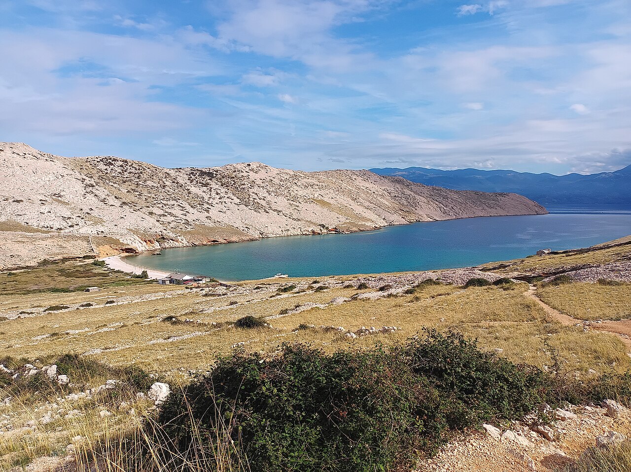
From Bunculuka on the east edge of Baška, a marked path climbs to the Rebica viewpoint (about 311 m) over Prvić, then zig-zags steeply down to two pebble bays, Vela and Mala Luka, which boats also visit and where there is a summer restaurant. It is about 5 km one way from Bunculuka (about 6 km from Baška harbour): allow 2–2.5 h each way. The official loop adds the Vrženica canyon: 14 km and 629 m of climbing (KRK HIKE 170, difficult).
Our tips
- Leave at 07:00, while the sun is still low.
- Walk out and take a taxi boat back to Baška. Check boat times at the harbour first.
- A camp entrance fee applies at Bunculuka (2026); ask at the gate.
- At midday in summer the bays fill with boats.
- Archaeology above the bays: Corinthia, a 6th-century Byzantine fort, and the Bosar settlement (KRK HIKE 170).
- The cliff variant is only for experienced hikers with a head for heights.
Good to know
- No shade; the climb back up from the bays is the hardest part.
- Busy with boats at midday in Jul–Aug.
- Slippery descent.
The details
- Where
- Baška (east)
- Season
- Year-round; the restaurant opens in summer
- Best time
- May–June and Sep–Oct. In summer, at dawn only.
- Getting there
- About 2 km on foot from Baška centre to Bunculuka, or drive to the car park there. The serpentine descent is slippery; sturdy shoes needed.
- Start
- Baška - Atrium Residence trail sign (Paid car parks in Baška; nearest to Bunculuka camp: "Oleander" (26 spaces). The path skirts this naturist camp; the tourist board warns of an entrance fee.)
- Distance
- 10.5 km, there and back
- Good for
- couples, groups, snorkelling, fit families
- Village guide
- Baška south-east coves: Bunculuka, Vrženica, Vela Luka and Mala Luka
- Official page
- KRK HIKE 170 - From Vrženica Canyon to Mala and Vela Luka Bay · KRK HIKE 171 - Baška's Rocky Challenge
Open on The Krk Map Directions in Google Maps · Apple Maps
Facts checked 31 Oct 2026
Also near here
- Vela Luka Beach · 0.0 km
- Corinthia Sight · 0.3 km
- Buymer fishing museum and tunera Sight · 0.4 km
- Mala Luka Beach · 1.0 km
- Mala Luka cove restaurant Eat · 1.0 km
Curated by Benjamin Haller and our guests · Facts checked 31 Oct 2026 · How this map is made
The Krk Map is made by Marim Luxury Villas, a family company that hosts guests in Stara Baška and Vrbnik. No place pays to be on it; partners and our curators’ own offers are marked. Our villas