What do you want to see?
Walk & view · Baška mountains
Walk to the Moon: Moon plateau and Hlam peak
Tested by us We have been here ourselves.
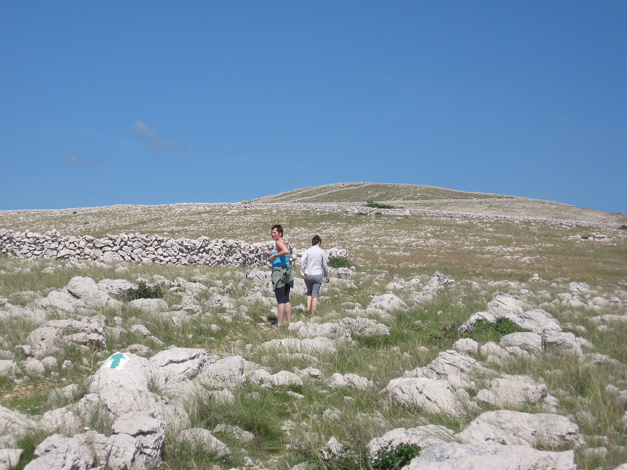
From Baška, a path climbs past Sv. Ivan church through pine forest and a gap in a drystone wall onto a bare, eroded limestone plateau at about 380 m, with views to Prvić, Rab, Sveti Grgur, Goli otok and Velebit. The plateau starts about 5 km from the town centre. Many walkers go on to Hlam (461 m, stone pyramid and cross), about 7 km one way from Baška: allow 4.5–5 h for the 14 km there and back. The official loop returns via Zakam: 15.3 km and 663 m of climbing (KRK HIKE 169).
Our tips
- In summer, start at first light.
- Close the pastoral gate behind you; the plateau is sheep pasture and the drystone walls (gromače, mrgari) are the attraction.
- Markings up here are non-standard (white-yellow-blue) and easy to lose on the way down. Load the GPX from krk-outdoor.hr before you go.
- Watch for griffon vultures from the Kuntrep reserve over the plateau.
- Mountain bikers use this trail too, so step aside for bikes on the narrow forest section.
- Name trap: this Hlam (461 m) is not Veli Hlam (482 m) above Stara Baška.
Good to know
- No shade and no water on the plateau: real sunstroke risk in summer.
- Sharp limestone: hiking shoes, not sandals.
- Crowded trailhead on fine days.
The details
- Where
- Baška
- Season
- Year-round trail; summer heat is dangerous
- Best time
- April to June and September to October. In July and August only from sunrise to about 10:00. Winter is fine on days without strong bura.
- Getting there
- Park at Sv. Ivan church (few spaces) or in Baška. Surface: built path through pine forest up to the plateau (about 5 km from the town centre, about 3 km from Sv. Ivan), then sharp rock and macadam. Shade: forest section only. Water: none.
- Start
- Baška - Atrium Residence trail sign (start of the marked trail) (Paid car parks in Baška, or a few street-side spaces below St John's church, which you can drive up to.)
- Distance
- 14 km, there and back, about 470 m of ascent
- Good for
- couples, groups, families with older kids, photography, dogs
- Village guide
- Baška mountains: the Moon plateau, Hlam, Obzova and the Glagolitic path
- Official page
- KRK HIKE 169 - To the Moon and Back · Outdoor - visitbaska.hr
Open on The Krk Map Directions in Google Maps · Apple Maps
Facts checked 31 Oct 2026
Also near here
- St John the Baptist (Sv. Ivan) church viewpoint above Baška Walk & view · 1.1 km
- Konoba Placa Eat · 1.5 km
- Holy Trinity church and Baška old town Sight · 1.5 km
- Bistro Francesca Eat · 1.6 km
- Konoba Doma Eat · 1.6 km
Curated by Benjamin Haller and our guests · Facts checked 31 Oct 2026 · How this map is made
The Krk Map is made by Marim Luxury Villas, a family company that hosts guests in Stara Baška and Vrbnik. No place pays to be on it; partners and our curators’ own offers are marked. Our villas