What do you want to see?
The Krk Map · Edition 2027
Walks, hikes and viewpoints on Krk
30 walks, hikes, viewpoints and rides on Krk, with where to start, the distance and climb where we have them, and the official trail page.
Where we'd start: Walk to the Moon, St John the Baptist (Sv. Ivan) church viewpoint above Baška, Obzova, Žlahtina trail through the Vrbnik vineyards, Baška Glagolitic Path and Baška to Vela Luka and Mala Luka coves.
Our top 10 walks & views
- Walk to the Moon Baška Tested by us
From Baška, a path climbs past Sv. Ivan church through pine forest and a gap in a drystone wall onto a bare, eroded limestone plateau at about 380 m, with views to Prvić, Rab, Sveti Grgur, Goli otok and Velebit. - St John the Baptist (Sv. Ivan) church viewpoint above Baška Baška
Small hilltop church and cemetery (about 125 m) on a switchback road above Baška: the classic postcard view over the old town, the 1.8 km Vela plaža and Prvić island with Velebit behind. - Obzova Baška mountains
The island's highest point (568 m; stone pyramid with a marble plaque) sits on a bare karst ridge between Punat and Baška. - Žlahtina trail through the Vrbnik vineyards Vrbnik
An easy 6.8 km loop (182 m of climbing) from Vrbnik along narrow paths through woods and the vineyards of the Vrbnik field, where Krk's own Žlahtina grape grows. - Baška Glagolitic Path Baška valley
An open-air alphabet of 34 carved stone letters in the Glagolitic script, placed from 2006 onwards and spread across the Baška valley. - Baška to Vela Luka and Mala Luka coves Baška
From Bunculuka on the east edge of Baška, a marked path climbs to the Rebica viewpoint (about 311 m) over Prvić, then zig-zags steeply down to two pebble bays, Vela and Mala Luka. - Stara Baška to Bracol cove coastal trail The south-west coast
A marked coastal route from Stara Baška, past St Jerome's church and Surbova beach and along a string of coves, to Bracol, with Prvić, Sveti Grgur and Velebit opening up ahead. - Vela Rika stream and waterfalls Draga Bašćanska
Vela Rika is a stream that flows for most of the year. - Rajska cesta Njivice
A coastal promenade from the Haludovo bathing area at the north end of Malinska towards Njivice. - Veli Hlam Stara Baška
Old shepherd paths, the only way overland before the road from Punat arrived in the 1980s, climb from the entrance to Stara Baška past old bauxite pits, mrgari and the Spuhotina pond to Veli Hlam (482 m).
Quick answers
What are the easiest walks on Krk?
Easy and nearly flat: the Paradise Path from Malinska towards Njivice (about 5 km one way, 39 m of climbing), the Prniba peninsula loop (8 km, 58 m) and the Petehova loop from Stara Baška harbour (2.5 km, about 1–1.5 h). The Žlahtina trail through the Vrbnik vineyards is an easy 6.8 km loop with 182 m of climbing.
Which walks on Krk have shade in summer?
Prniba runs through dense pine forest, so even midday is bearable in summer, and the Paradise Path is shaded by Aleppo pine, cypress and downy oak; both pass coves to swim in. The Poljica loop goes through oak woods to a 400-year-old oak, and the forest path from Sv. Ivan above Baška is shaded up to the plateau gate, though the plateau beyond has no shade.
Which walks on Krk are good with small children?
The Prniba loop suits all ages, with shade and small rocks for swimming. Above Baška, walk only the shaded forest section from Sv. Ivan to the drystone gate and turn back; in the Baška valley, children can take a rubbing of each stone letter on the Glagolitic Path.
How do I walk to the Moon plateau from Baška?
From Sv. Ivan church above Baška, a built, pine-shaded path climbs about 3 km (about 1 h) to a gate in a drystone wall, where the bare plateau begins at about 380 m. Many walkers go on to Hlam (461 m) on the Walk to the Moon: 14 km there and back from Baška, 4.5–5 h. There is no shade or water on the plateau: in July and August, walk only from sunrise to about 10:00.
What is the highest mountain on Krk?
Obzova, 569 m, on a bare karst ridge between Punat and Baška. The easiest way up starts at Treskavac pass on the D102: the official loop is 9.4 km with 320 m of climbing, about 3 h, with no water and almost no shade.
Open them all on the interactive map, or read the list below. Places with their own page are first.
- Walk to the Moon Baška
- St John the Baptist (Sv. Ivan) church viewpoint above Baška Baška
- Obzova Baška mountains
- Žlahtina trail through the Vrbnik vineyards Vrbnik
- Baška Glagolitic Path Baška valley
- Baška to Vela Luka and Mala Luka coves Baška
- Stara Baška to Bracol cove coastal trail The south-west coast
- Vela Rika stream and waterfalls Draga Bašćanska
- Rajska cesta Njivice
- Veli Hlam Stara Baška
- Diviška pond and peak Baška
- Bag peak and the south-west ridge above Baška Baška
- Baška valley educational trail Baška valley
- Cycling to the Moon Baška
- Stara Baška to Baška over the Vratudih pass Stara Baška
- Camino Krk Krk Town
- Poljica's 400-year-old oak and Čavlena bay Šotovento
- Prniba peninsula pine-forest walk Krk Town
- Punat coast to St Nicholas church Punat
- Tri križi viewpoint and Veli vrh above Punat Punat
- Bauxite Story loop Stara Baška
- Mali Hlam Vrbnik hinterland
- Park Dubec viewpoint Omišalj
- Petehova cove loop from Stara Baška harbour Stara Baška
- Punat old core and the riva Punat
- All Saints parish church and the cemetery hill Stara Baška
- Vela Vrženica canyon scramble Baška
- Vrbnik Vrbnik
- Baška valley easy family ride Baška valley
- Voz peninsula Omišalj
Walk to the Moon: Moon plateau and Hlam peak
Walk & view · Baška
Tested by us We have been here ourselves.
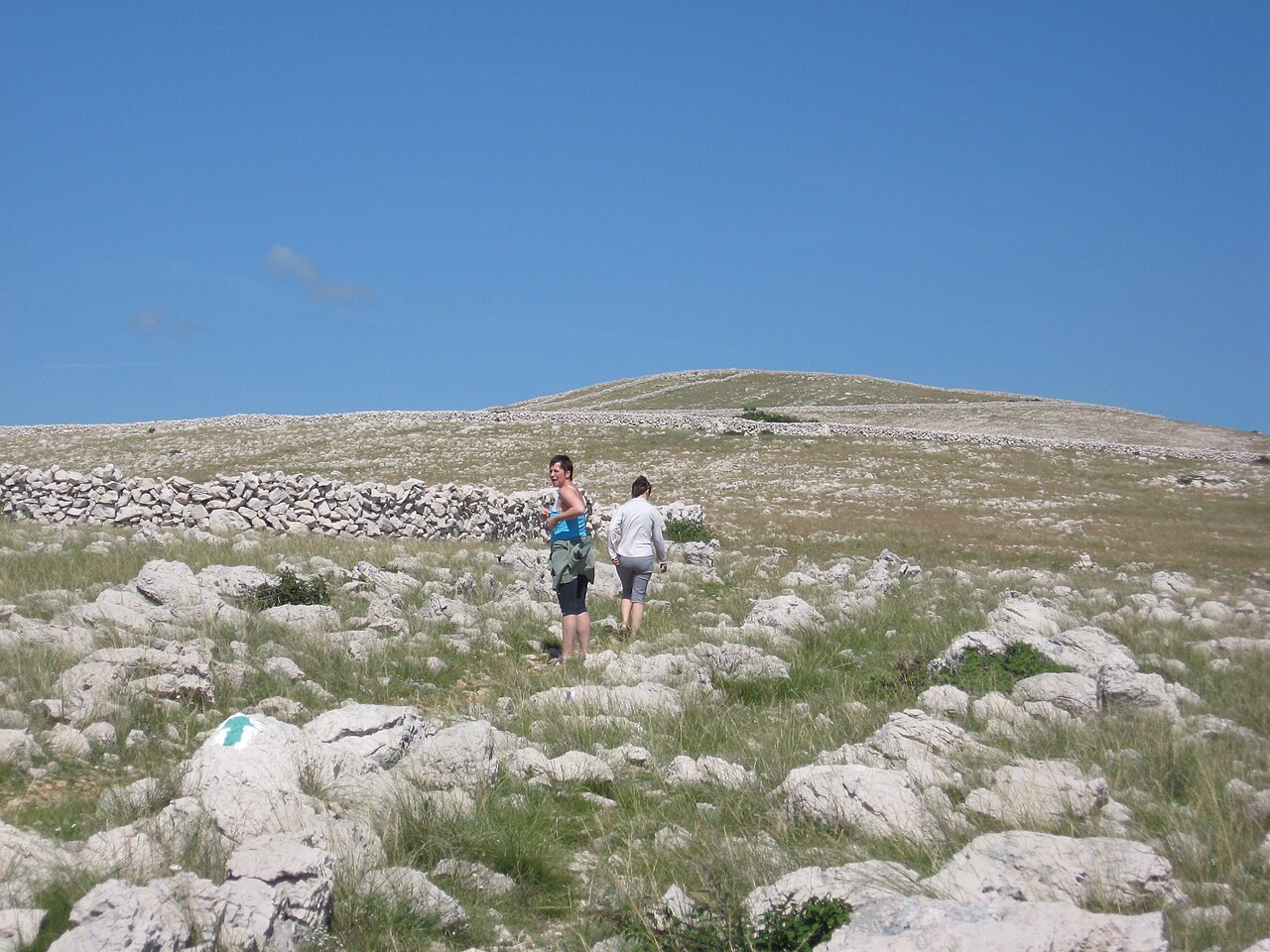
From Baška, a path climbs past Sv. Ivan church through pine forest and a gap in a drystone wall onto a bare, eroded limestone plateau at about 380 m…
St John the Baptist (Sv. Ivan) church viewpoint above Baška
Walk & view · Baška
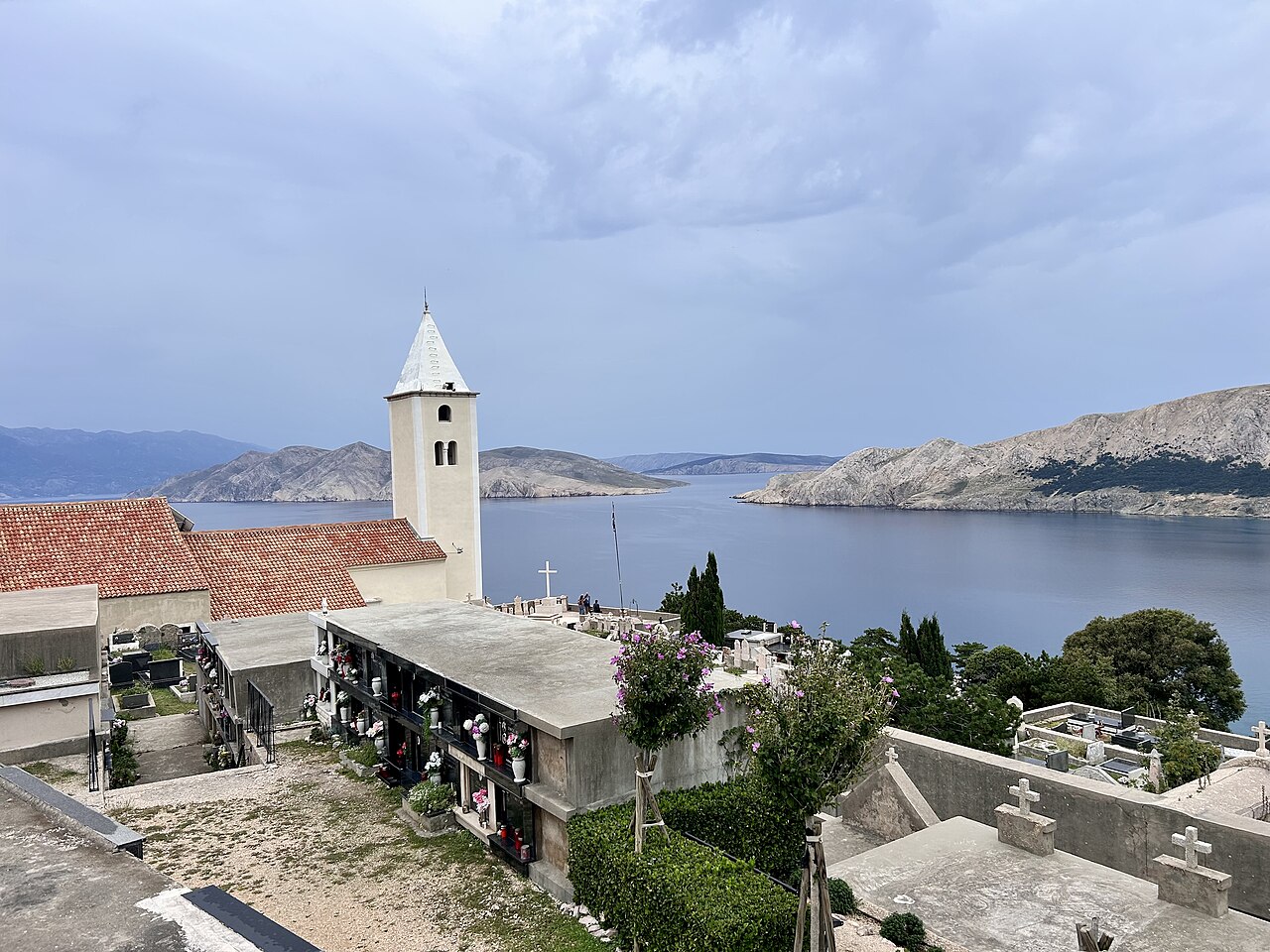
Small hilltop church and cemetery (about 125 m) on a switchback road above Baška: the classic postcard view over the old town, the 1.8 km Vela plaža…
Obzova (568 m), Krk's highest peak
Walk & view · Between Punat and Baška (Treskavac)
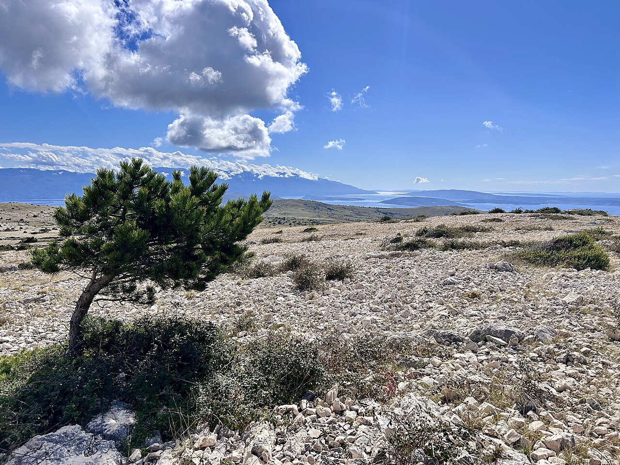
The island's highest point (568 m; stone pyramid with a marble plaque) sits on a bare karst ridge between Punat and Baška.
Žlahtina trail through the Vrbnik vineyards
Walk & view · Vrbnik / Vrbnik field
An easy 6.8 km loop (182 m of climbing) from Vrbnik along narrow paths through woods and the vineyards of the Vrbnik field, where Krk's own Žlahtina grape grows. On the way are views to the Vinodol riviera and a lookout over the field at Črnikov.
Our tips
- Finish with a glass of Žlahtina in Vrbnik's old town.
- The Frankopan pathways walk from Vrbnik also crosses the vineyards and is undemanding.
Good to know
- Working vineyards: stay on paths.
- Where
- Vrbnik / Vrbnik field
- Season
- Year-round
- Best time
- Late afternoon; Sep for harvest atmosphere; spring for green vines
- Getting there
- Start in Vrbnik. Narrow paths, woods and vineyard tracks; partial shade.
- Start
- Vrbnik (old town)
- Distance
- 6.8 km, round trip, about 182 m of ascent
- Good for
- couples, families, grandparents, foodies, dogs
- Village guide
- The Vrbnik field, Risika, Garica, Kampelje and the coast road to Sv. Marak
- Official page
- KRK HIKE 185 - Žlahtina trail · KRK HIKE 185 - Put žlahtine
Open on The Krk Map Directions in Google Maps · Apple Maps
Facts checked 31 Oct 2026
Baška Glagolitic Path: 34 stone letters from Treskavac to Bunculuka
Walk & view · Baška valley
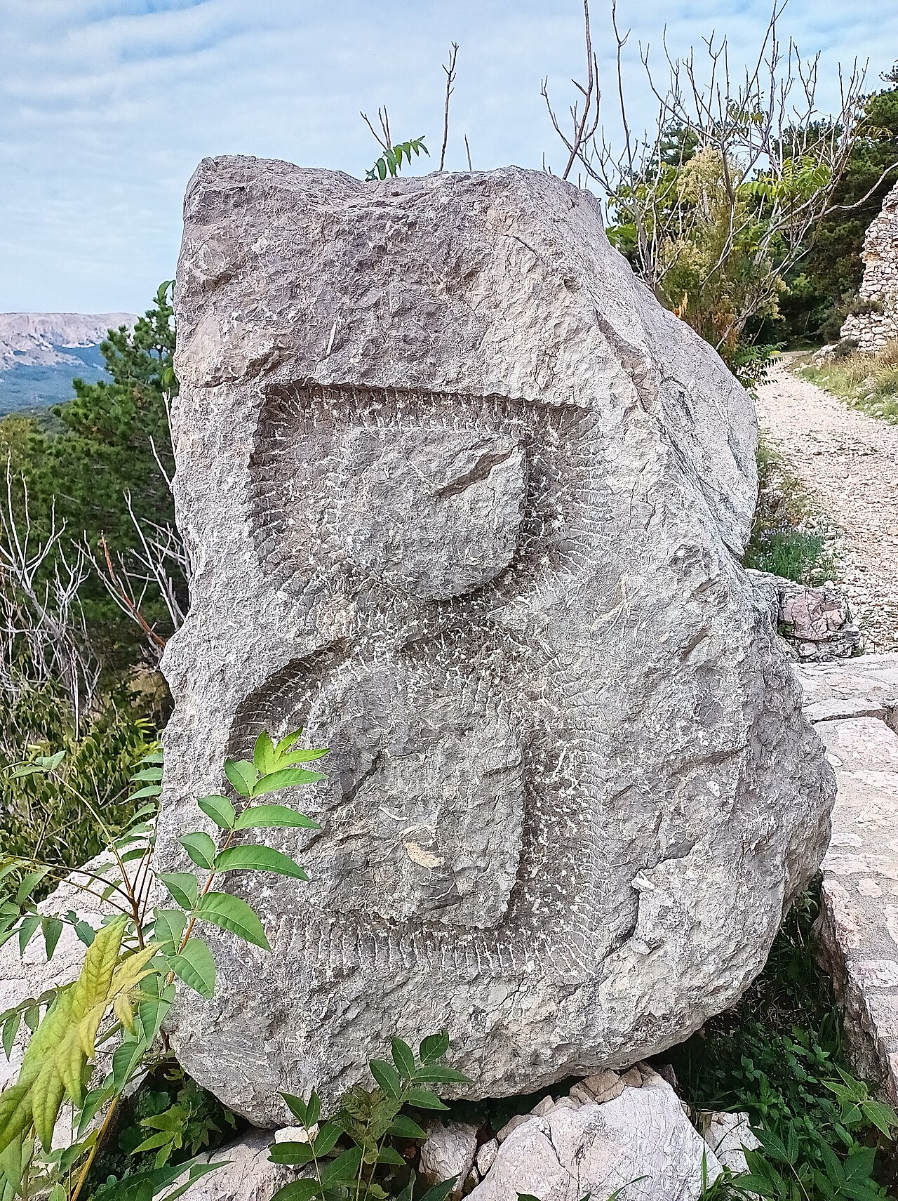
An open-air alphabet of 34 carved stone letters in the Glagolitic script, placed from 2006 onwards and spread across the Baška valley.
Baška Glagolitic Path: tips, how to get there and what to know →
Baška to Vela Luka and Mala Luka coves
Walk & view · Baška (east)
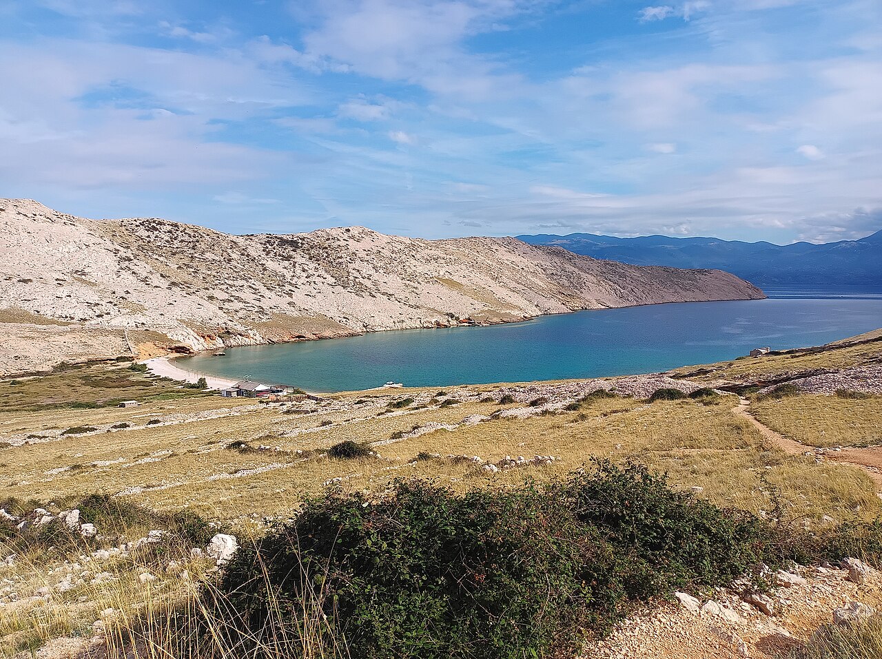
From Bunculuka on the east edge of Baška, a marked path climbs to the Rebica viewpoint (about 311 m) over Prvić, then zig-zags steeply down to two…
Baška to Vela Luka and Mala Luka coves: tips, how to get there and what to know →
Stara Baška to Bracol cove coastal trail
Walk & view · Stara Baška to Baška south coast
A marked coastal route from Stara Baška, past St Jerome's church and Surbova beach and along a string of coves, to Bracol, with Prvić, Sveti Grgur and Velebit opening up ahead. The full loop back via the Vraca pass, Vaclav's ridge and Vratudih is about 16.8 km with about 1,000 m of climbing, roughly 7.5–8 h with breaks: wild, rough and fully exposed.
Our tips
- Park at restaurant Mariana's waterfront lot or the gravel car park at Zala.
- Swim stops at Surbova (pebble) and Bracol.
- Bracol has a café/grill reachable only on foot or by boat. Confirm it is open before relying on it.
- The most striking views are between the Vraca pass and the Ljubimer junction.
Good to know
- No shade anywhere.
- Narrow, exposed sections: not in bura.
- Experienced, fit hikers only.
- Where
- Stara Baška to Baška south coast
- Season
- Spring/autumn; few facilities outside summer
- Best time
- Outside summer: Mar–May, Oct–Nov
- Getting there
- Start in Stara Baška. Karst limestone the whole way, markings present but terrain rough. No shade at all.
- Start
- Stara Baška harbour trail sign (By restaurant Mariana or at the pay car parks above Zala (the lower one EUR 1 an hour from May to September, the upper one EUR 1.40 an hour from June to September, 2025).)
- Distance
- 5.6 km, one way, about 211 m of ascent
- Good for
- fit couples, groups, snorkelling, photography
- Village guide
- The south-west coast: Oprna to Surbova
- Official page
- KRK HIKE 168
Open on The Krk Map Directions in Google Maps · Apple Maps
Facts checked 31 Oct 2026
Vela Rika stream and waterfalls from the Žanac spring
Walk & view · Draga Bašćanska / Treskavac
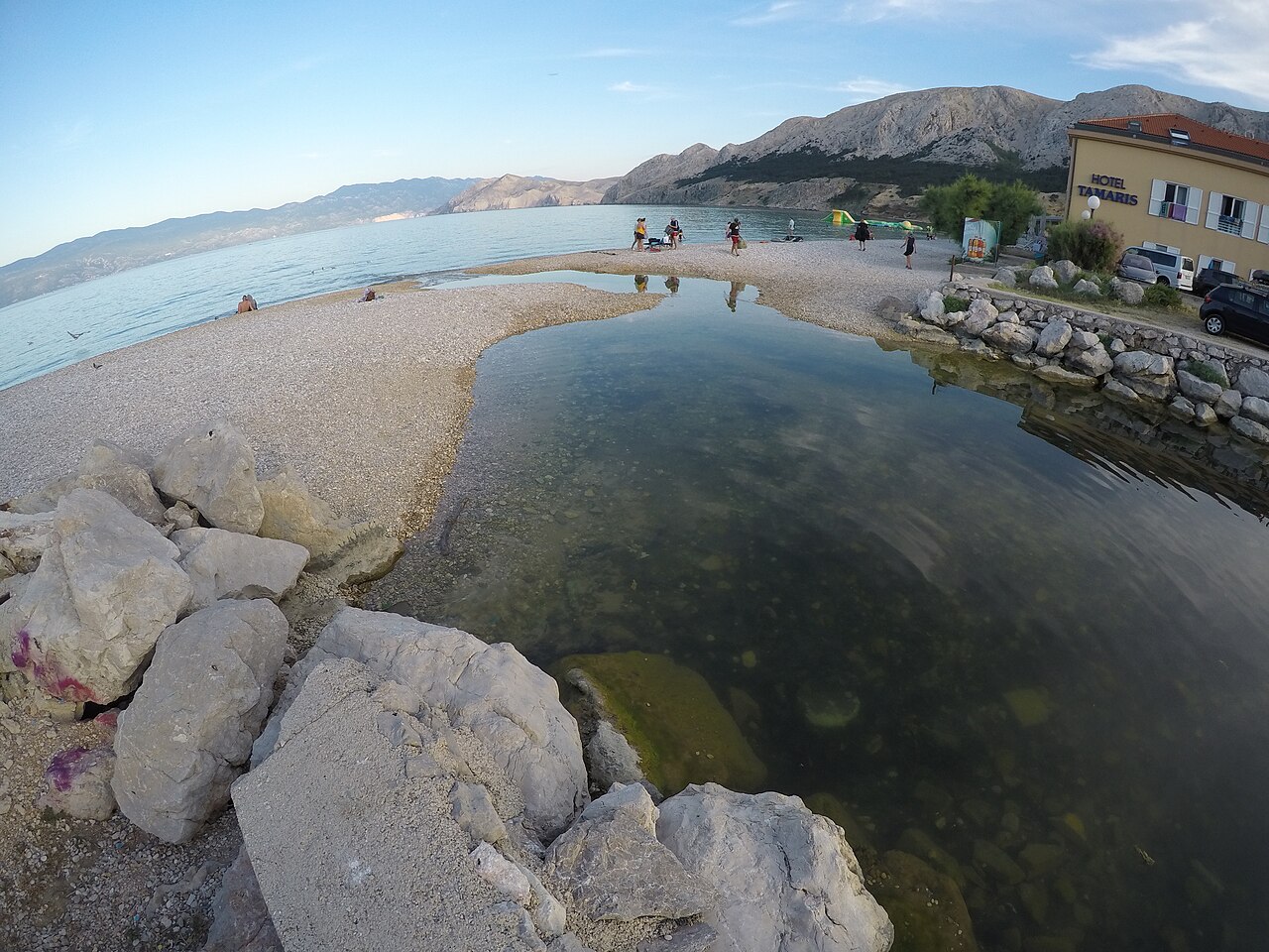
Vela Rika is a stream that flows for most of the year.
Vela Rika stream and waterfalls: tips, how to get there and what to know →
Rajska cesta (Paradise Path), Malinska to Njivice
Walk & view · Malinska–Njivice
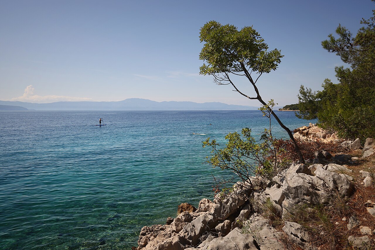
A coastal promenade from the Haludovo bathing area at the north end of Malinska towards Njivice: about 5 km one way and nearly flat (KRK HIKE 111, 39 m of climbing), shaded by Aleppo pine, cypress and downy oak, with coves to swim in along the way. Work on it began in 1934; it was completed in 2024.
Our tips
- Walk it one way and have dinner at 7 Seas in Njivice.
- Where
- Malinska–Njivice
- Season
- Year-round
- Best time
- Late afternoon
- Getting there
- Start at the Haludovo bathing area at the north end of Malinska, or from the Njivice end.
- Start
- Haludovo (bathing area at the start of the promenade) (Haludovo bathing-area car park, or the 10-space car park by Beach bar Paradajz.)
- Distance
- 5.1 km, one way, about 39 m of ascent
- Good for
- couples, families, dogs
- Village guide
- Njivice
- Official page
- KRK HIKE 111 - The Paradise Road · H111 - Rajska cesta
Open on The Krk Map Directions in Google Maps · Apple Maps
Facts checked 31 Oct 2026
Veli Hlam (482 m), Stara Baška's home mountain
Walk & view · Stara Baška
Old shepherd paths, the only way overland before the road from Punat arrived in the 1980s, climb from the entrance to Stara Baška past old bauxite pits, mrgari and the Spuhotina pond to Veli Hlam (482 m), with views over the Kvarner islands and Velebit. The official loop carries on along the ridge to the Vratudih pass, with views down to Baška, and returns past the Šibenik double pond: 9.2 km and 400 m of climbing (KRK HIKE 147, difficult), about 3–3.5 h.
Our tips
- A longer variant: from Camp Škrila up the switchbacks of road 5125, along the ridge past the Jasenova cave to the top, and back past the Spuhotina water source (11.3 km, 516 m of climbing, 3.5 h).
- A large stone wall marks the summit. If you get disoriented, head east.
- Swim in Stara Baška afterwards.
Good to know
- Steep initial climb.
- Little shade.
- Don't confuse it with Hlam (461 m) on the Baška Moon plateau.
- Where
- Stara Baška
- Season
- Year-round
- Best time
- Spring/autumn; summer only at dawn
- Getting there
- Start at the entrance to Stara Baška or Camp Škrila. Rocky path, macadam and tarmac. Shade sparse higher up. Ponds are livestock water.
- Start
- Marked trailhead at the upper entrance of Stara Baška, about 130 m from All Saints church (Free unpaved car park near the harbour.)
- Distance
- 9.2 km, round trip, about 400 m of ascent
- Good for
- couples, groups, dogs, photography
- Village guide
- Stara Baška
- Official page
- KRK HIKE 147 - The Story of Mali and Veli
Open on The Krk Map Directions in Google Maps · Apple Maps
Facts checked 31 Oct 2026
Diviška pond and peak (Moon plateau extension)
Walk & view · Baška (Draga Bašćanska side of the plateau)
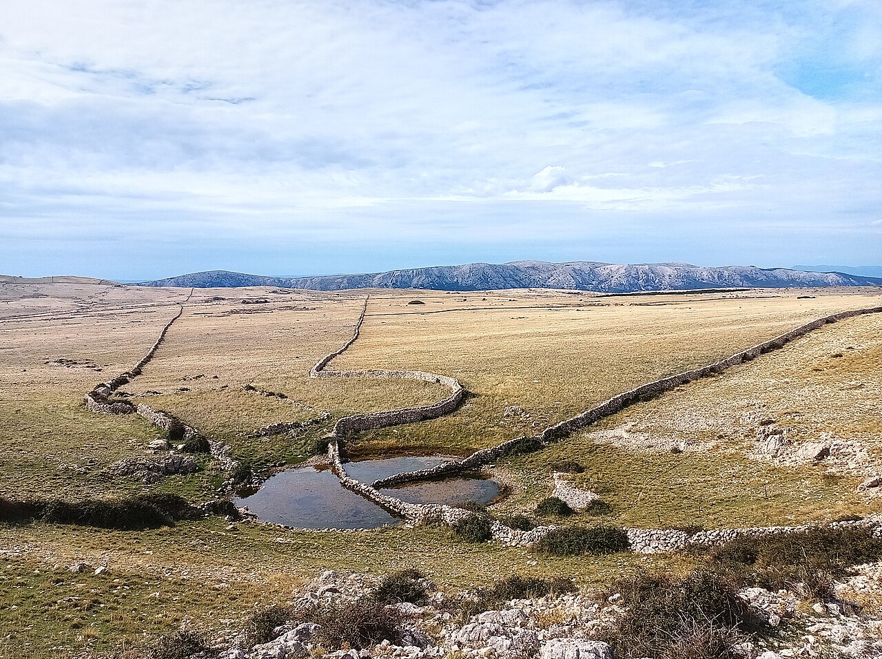
Past the main plateau, a longer out-and-back from Sv. Ivan reaches Diviška pond at about 450 m, a rare water point up here: its drystone walls were…
Diviška pond and peak: tips, how to get there and what to know →
Bag peak and the south-west ridge above Baška (Ljubimer, Vraca, Bracol, Škuljica)
Walk & view · Baška (west side of the bay)
Bag (185 m) is the southernmost peak near Baška, with a wide view down onto Baška, Vela plaža and Prvić. The official loop from Zarok (the west end of Vela plaža) climbs to the Vraca pass and Bag, drops to the pebble cove at Cape Škuljica and returns via the Ljubimer pass: 8.6 km and 409 m of climbing (KRK HIKE 167, rated easy). The longer loop via Vela Draga, Bracol cove and the St Nicholas ruins is 14.3 km and 502 m (KRK HIKE 168).
Our tips
- The Ljubimer mrgari (flower-shaped sheepfolds) look over the whole Baška basin. This is the photo stop.
- Bracol cove, on the longer loop, has a small café/grill reachable only on foot or by boat; check it is open before you rely on it.
- Swim stop: the sheltered pebble cove at Cape Škuljica, by the lighthouse, is on the 8.6 km loop.
- Even in early June, take 4–4.5 L of water each.
- It works in winter too: a 12.6 km variant over Vorganj (393 m), the St Nicholas ruins and Bag climbs about 860 m in roughly 5 h.
- Best in spring, when sage and lavender are in flower.
Good to know
- Full sun on most of the loop.
- Rocky, steep sections near the climbing crags.
- Carry plenty of water.
- Where
- Baška (west side of the bay)
- Season
- Year-round except summer midday
- Best time
- Mar–Jun and Sep–Nov; early morning.
- Getting there
- Park at Zarok (end of the paved road) or by Baška Beach camping. Colour-coded marked trails. Rocky karst, herb scrub, some forest on the return.
- Start
- Zarok trail sign (west end of Vela plaža) (Paid car park at Zarok (60 spaces) or in Baška.)
- Distance
- 8.6 km, round trip, about 409 m of ascent
- Good for
- couples, groups, snorkelling, photography
- Village guide
- Baška
- Official page
- KRK HIKE 167 - A beautiful Mix of the Karst, the Sea and Mediterranean Herbs · KRK HIKE 168 - Walking along the Southwestern Ridge to the Baška Valley
Open on The Krk Map Directions in Google Maps · Apple Maps
Facts checked 31 Oct 2026
Baška valley educational trail: Zarok - Batomalj - Pod Lipica
Walk & view · Baška valley / Batomalj
A family-oriented heritage loop through the Baška valley: the Zarok sands, the Vela Rika stream, the stone hamlet of Batomalj, the Marian shrine of Our Lady of Gorica (237 votive steps) and the mrgari sheepfolds at Lipica. The official loop is 10.5 km with 474 m of climbing (KRK HIKE 166, rated easy): plan a half-day. Shorter versions of about 6 km are possible.
Our tips
- Visit the Gorica sanctuary, a Marian shrine and pilgrimage site since the 16th century; the official route comes down its votive steps.
- Mrgari, flower-shaped drystone sheep-sorting pens, are a speciality of Baška and Prvić; you pass one at Lipica.
- Finish with a swim on Vela plaža.
- Information boards line the trail. The tourist board guide is online or at the tourist office.
Good to know
- Sheep pastures: leash dogs and close gates.
- Where
- Baška valley / Batomalj
- Season
- Year-round
- Best time
- Spring and autumn; summer mornings
- Getting there
- Start at Zarok (west end of Vela plaža). Pasture tracks, drystone walls, pine forest. Partial shade.
- Start
- Zarok trail sign (Paid car park at Zarok or in Baška.)
- Distance
- 10.5 km, round trip, about 474 m of ascent
- Good for
- families, kids, dogs, history lovers
- Village guide
- Baška valley: Treskavac, Draga Bašćanska, Batomalj and Jurandvor
- Official page
- KRK HIKE 166 - A Walk along the educational Trail · Outdoor - visitbaska.hr: Educational trail Baška-Zarok-Batomalj-Pod Lipicu
Open on The Krk Map Directions in Google Maps · Apple Maps
Facts checked 31 Oct 2026
Cycling to the Moon: Baška's classic MTB loop
Walk & view · Baška
Baška's classic MTB loop (KRK BIKE 452): 26.5 km and about 690 m of climbing from Baška via Sv. Ivan onto the Moon plateau, then back past Mošuna and the vineyards. It has technical rocky sections and shares the Moon plateau hiking trail. Alternatives are the Vela Rika canyon ride (KRK BIKE 453, with stream crossings) and the demanding Portafortuna singletrails (11 km, 327 m of climbing).
Our tips
- Ride the Moon route uphill.
- Water stop: the Žanac spring by Mošuna on the D102.
- The plateau has long stretches with no shade, so plan your rests.
- The 4 Islands MTB stage race starts in Baška; expect busy trails on race days (check the dates).
Good to know
- Shared with many hikers: give way.
- Technical rocky terrain.
- No shade on the plateau.
- Where
- Baška
- Season
- Year-round
- Best time
- Spring/autumn; summer only at dawn
- Getting there
- Start in Baška town centre. Rocky plateau and off-road sections.
- Start
- Baška centre
- Distance
- 26.5 km, round trip, about 690 m of ascent
- Good for
- mountain bikers, groups
- Official page
- KRK BIKE 452 - Cycling to the Moon · Outdoor
Open on The Krk Map Directions in Google Maps · Apple Maps
Facts checked 31 Oct 2026
Stara Baška to Baška over the Vratudih pass
Walk & view · Stara Baška / Baška
The classic crossing between the two Baškas: it climbs bare, bura-scoured slopes from Stara Baška to the Vratudih pass (about 350 m), then drops through greener country and the hamlet of Batomalj into Baška. About 8 km one way, 3–4 h, rated difficult for the steep rocky climb.
Our tips
- The marked trailhead is about 200 m inside Stara Baška from the village entrance. The first 30 min are steep; then the view back over Stara Baška and the camp opens up.
- Make a small detour to the power-line viewpoint above Baška for a wide panorama over the valley.
- If you lose the markings on the plateau, head east, towards sunrise: Baška lies that way.
- It is one way: arrange a pick-up in Baška (about 35 minutes' drive back via Punat). Pack swimwear and finish at Vela plaža.
Good to know
- Steep, rocky, exposed climb: not at midday in summer.
- One way: transport back needed.
- Bura makes the pass unpleasant or dangerous.
- Where
- Stara Baška / Baška
- Season
- Year-round except heat and bura days
- Best time
- Spring and autumn, early start. Summer only at dawn.
- Getting there
- Trailhead in Stara Baška near the village entrance (parking before the village). Red-white markings. Rock and low scrub on the Stara Baška side, then path/asphalt via Batomalj. No shade on the climb.
- Start
- Stara Baška trailhead sign (start of the marked trail to Baška) (Free unpaved car park near the harbour, or paid street parking (20 spaces).)
- Distance
- 8 km, one way, about 332 m of ascent
- Good for
- couples, groups, fit families
- Village guide
- Stara Baška
- Official page
- Outdoor map Baška - Punat - Stara Baška
Open on The Krk Map Directions in Google Maps · Apple Maps
Facts checked 31 Oct 2026
Camino Krk (150 km, 7 stages)
Walk & view · Island-wide
A 150 km pilgrimage walk around the island, waymarked since 2019. It starts at Krk Cathedral in Krk Town and goes via Brzac, Malinska, Omišalj, Čižići, Vrbnik and Baška to St James's church in Kornić, with blue-and-yellow signs; stamps in a pilgrim passport earn a certificate. Stages are about 19–23 km. Stage 6, Vrbnik to Baška (23 km, 678 m of climbing, difficult), crosses the Vrbnik field, the Moon plateau and the Kuntrep reserve.
Our tips
- Stage 6 starts in Vrbnik and ends in Baška: walk it one way and take a taxi back.
- Pilgrim passports and printed maps are at the Krk Town tourist office; GPS tracks are on Maps.me.
- Single stages work well as day hikes.
Good to know
- Stage 6 crosses exposed karst: not in summer heat.
- Where
- Island-wide
- Season
- Year-round
- Best time
- April–June, September–October
- Getting there
- Stages start and end in villages; plan transport between them.
- Start
- Krk cathedral, Krk Town
- Distance
- 152 km, one way, about 3043 m of ascent
- Good for
- couples, groups, fit hikers
- Village guide
- Krk Town
- Official page
- CAMINO KRK day 1: Krk - Brzac
Open on The Krk Map Directions in Google Maps · Apple Maps
Facts checked 31 Oct 2026
Poljica's 400-year-old oak and Čavlena bay
Walk & view · Šotovento (west Krk, towards Glavotok)
On the sheltered west side of the island, a 6.6 km loop (140 m of climbing, KRK HIKE 128) from Poljica church runs through oak woods to a great oak: about 400 years old, 20 m tall, with a 30 m crown. On the way are two karst ponds and Čavlena bay, facing Cres, for a swim.
Our tips
- Best in spring, when the oak is in fresh leaf.
- There's a short steep macadam climb before the forest.
- On hot days, head for the west-coast forests (Dubašnica, Glavotok, Porat) for shade: the woods around Porat suit dog walks, and Glavotok's forest trails make good half-day loops.
Good to know
- Short steep macadam section.
- Where
- Šotovento (west Krk, towards Glavotok)
- Season
- Year-round
- Best time
- Spring; summer mornings (shade)
- Getting there
- Park near the parish church of SS Cosmas and Damian, Poljica. Woodland paths and macadam.
- Start
- Poljica, car park by the parish church of SS Cosmas and Damian (Car park in the centre of Poljica, by the church.)
- Distance
- 6.6 km, round trip, about 140 m of ascent
- Good for
- families, kids, dogs, hot days, snorkelling
- Village guide
- Poljica, Milohnići and the Šotovento oak country
- Official page
- KRK HIKE 128 - In the Shade of Great Oaks · H128 In the shade of great oaks
Open on The Krk Map Directions in Google Maps · Apple Maps
Facts checked 31 Oct 2026
Prniba peninsula pine-forest walk
Walk & view · Prniba (between Punat and Krk Town)
A flat 8 km loop (58 m of climbing) through a dense, non-native Aleppo pine forest on the Prniba peninsula opposite Košljun. Along it are the St Lucy chapel (first mentioned 1424), the ruins of St Vitus, a pond, the old St Nicholas pier, and small secluded rocks for swimming. It suits all ages, and the shade makes it pleasant even in summer.
Our tips
- A good hot-day family walk: shade plus swimming.
- Several variants let you shorten it.
- Walk out to the old St Nicholas (Sv. Mikul) pier for the Košljun view.
Good to know
- Gravel road.
- Where
- Prniba (between Punat and Krk Town)
- Season
- Year-round
- Best time
- Any time; in summer even midday is bearable in the shade
- Getting there
- Start at the chapel of St Lucy on the Prniba peninsula; park at the roadside on the gravel road. Natural forest paths.
- Start
- Chapel of St Lucy (Sv. Lucija), near Ulica Narodnog Preporoda, Krk
- Distance
- 8.1 km, round trip, about 58 m of ascent
- Good for
- families, kids, grandparents, dogs, hot days, snorkelling, couples
- Village guide
- Krk Town
- Official page
- KRK HIKE 127 - A Walk through the Green Peninsula
Open on The Krk Map Directions in Google Maps · Apple Maps
Facts checked 31 Oct 2026
Punat coast to St Nicholas church and Tranjevo lighthouse
Walk & view · Punat
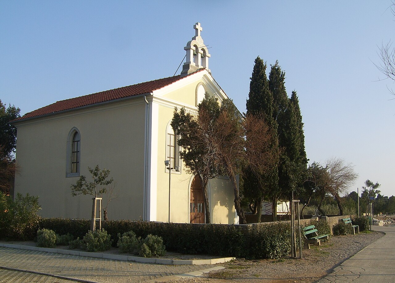
From Punat's southern promenade, a nearly flat coastal walk (11.4 km there and back, about 30 m of climbing) runs along pebble coves and cliffs to the secluded seaside church of St Nicholas and the Tranjevo lighthouse (1874), where the 45th parallel crosses. On the way are Illyrian hillfort traces at Veli and Mali Kaslir, and views to Kormat, Plavnik, Cres and Krk Town.
Our tips
- Take swimming things: the coves along the way are the point.
- The Cape Negrit section has steep cliffs, so keep kids close.
Good to know
- Cliff edges at Cape Negrit.
- Little shade.
- Where
- Punat
- Season
- Year-round
- Best time
- Morning or late afternoon; evenings for the promenade part
- Getting there
- Start at Punat's southern promenade; return the same way.
- Start
- Punat, southern promenade
- Distance
- 11.4 km, there and back, about 30 m of ascent
- Good for
- families, snorkelling, dogs, evening walk
- Village guide
- Punat and Košljun
- Official page
- KRK HIKE 142 - The Story of St Nicholas
Open on The Krk Map Directions in Google Maps · Apple Maps
Facts checked 31 Oct 2026
Tri križi viewpoint and Veli vrh above Punat (hike or MTB)
Walk & view · Punat
Above Punat, the Tri križi (three stone crosses with benches) look over Punat bay, Košljun and the Prniba peninsula. They lie on the official Shepherd's Story loop (KRK HIKE 143: 16.7 km, 630 m of climbing, difficult), which climbs from Punat via St Nicholas chapel to Obzova, Brestovica and Veli vrh and comes back down past the crosses. The Farmer's Story loop (KRK HIKE 144: 16.5 km, 580 m of climbing) goes through olive groves past a komarda stone hut and the Kaljužina pond to Veli vrh, without the crosses. Mountain bikers know the hill for ramps over 20% and a technical 2 km descent.
Our tips
- The descent is rocky and demanding; poles help.
- Riders: KRK BIKE 442 is for technically advanced riders only, with little room for error on the descent.
- The Kaljužina pond on the way can dry out in summer.
Good to know
- Demanding rocky descent.
- MTB descent is enduro-level.
- Little shade higher up.
- Where
- Punat
- Season
- Year-round
- Best time
- Spring/autumn; summer only early
- Getting there
- Start in Punat centre (tourist office). Olive groves, then rocky path and drystone walls.
- Start
- Punat centre (Trailheads: tourist office (route 144), Prgon (below the water tank), Ricomp (K ribaru inn or cemetery), Za Rimon (near the hunting lodge).)
- Distance
- 16.7 km, round trip, about 630 m of ascent
- Good for
- groups, couples, mountain bikers, sunset
- Official page
- KRK HIKE 143 - The Shepherd's Story · KRK HIKE 144 - The Farmer's Story
Open on The Krk Map Directions in Google Maps · Apple Maps
Facts checked 1 Nov 2026
Bauxite Story loop: Oprna and the old mining coves
Walk & view · Stara Baška
A 6.6 km loop with 300 m of climbing from Camp Škrila at Stara Baška (KRK HIKE 146, medium). It follows the rocky coast past a string of wild coves where WWI-era bauxite pits are still visible (more than 250 islanders once worked here), climbs to the Velo Čelo viewpoint, then descends a steep rocky path to Oprna beach for a swim.
Our tips
- Short version to Oprna only: park at the pull-outs on the Punat-Stara Baška road and take the steep path down, about 10–15 minutes.
- Bring plenty of water and sunscreen.
Good to know
- Steep, rocky descent to Oprna.
- Strong sun on exposed coast.
- Oprna crowded from late morning in July and August.
- Where
- Stara Baška
- Season
- Year-round
- Best time
- Spring/autumn; summer only early morning
- Getting there
- Start at Camp Škrila, Stara Baška. Rocky paths, bush, and a steep descent to Oprna. Little shade.
- Start
- Camp Škrila (Škrila Sunny Camping), Stara Baška (Paid gravel car park for camp customers (EUR 13 a day).)
- Distance
- 6.6 km, round trip, about 300 m of ascent
- Good for
- couples, snorkelling, groups
- Village guide
- The south-west coast: Oprna to Surbova
- Official page
- KRK HIKE 146 - The Bauxite Story
Open on The Krk Map Directions in Google Maps · Apple Maps
Facts checked 31 Oct 2026
Mali Hlam (446 m): a wide view over the Vrbnik field
Walk & view · Vrbnik hinterland / Treskavac
Mali Hlam (446 m) is the quiet summit above the Vrbnik field: from the top you see the vineyard mosaic, Vrbnik and the coast in detail. The official 7.8 km loop from Vrbnik (KRK HIKE 186, 297 m of climbing, medium) passes the Lokva ponds and a viewpoint over the field and climbs beneath Mali Hlam, but does not reach the top. For the summit itself, walk the 14 km loop from Treskavac (564 m of climbing, about 5 h).
Our tips
- On the Treskavac loop one side is loose scree with poor markings: walk it so that you climb the scree rather than descend it, and take poles.
- Watch for old electric-fence wire and grazing sheep.
Good to know
- Steep scree descent.
- Old electric fencing.
- Markings are patchy in places.
- Where
- Vrbnik hinterland / Treskavac
- Season
- Year-round except summer midday
- Best time
- Spring/autumn; clear mornings for the field view
- Getting there
- From Vrbnik village (KRK HIKE 186) or from the gravel car park at Treskavac. Earth path through forest, then rocky karst; markings patchy on the descent.
- Start
- Vrbnik (Paid car parks at the edge of Vrbnik, e.g. Vajavina (EUR 2/h, EUR 15/day, June–September, 2026).)
- Distance
- 7.8 km, round trip, about 297 m of ascent
- Good for
- couples, groups, photography
- Village guide
- The Vrbnik field, Risika, Garica, Kampelje and the coast road to Sv. Marak
- Official page
- KRK HIKE 186 - Beneath Mali Hlam Peak · Vrbnik's hiking round trip
Open on The Krk Map Directions in Google Maps · Apple Maps
Facts checked 1 Nov 2026
Park Dubec viewpoint, Omišalj
Walk & view · Omišalj (old town, north end)
A wooded park at the end of Omišalj's clifftop old town, created from 1925 onwards by the town's spa commission, with stairs and trails down towards the sea. The view reaches across Omišalj bay and the Kvarner to Velebit. It is the start of the walk down to Roman Fulfinum.
Our tips
- Start the Fulfinum walk here and go down on foot rather than driving.
- Pick a clear day for the long views.
Good to know
- Stairs down towards the sea.
- Where
- Omišalj (old town, north end)
- Season
- All year
- Best time
- Morning or late afternoon
- Getting there
- On foot from the old town, by the church of St Anthony (Dubec 9).
- Good for
- couples, families, sunset, dogs
- Village guide
- Omišalj, Fulfinum-Mirine and Voz bay
Open on The Krk Map Directions in Google Maps · Apple Maps
Facts checked 31 Oct 2026
Petehova cove loop from Stara Baška harbour
Walk & view · Stara Baška
Tested by us We have been here ourselves.
An easy 2.5 km coastal loop from Stara Baška harbour past Petehova cove (with a lone villa above it) and back via the road: about 1–1.5 h with only about 50 m of climbing. Along the way are flowering sage, free-roaming sheep and views to Rab and Goli otok.
Our tips
- Parking at the harbour is paid in season.
- The coast faces south and south-west, so the light is at its best in the late afternoon.
Good to know
- Short road section on the return.
- A private villa sits above the cove: keep to the path past it.
- Where
- Stara Baška
- Season
- Year-round
- Best time
- Evening or early morning
- Getting there
- Start at Stara Baška harbour: the coastal path out, the road back. Easy all the way.
- Start
- Stara Baška harbour ('Mul') (Harbour car park, paid in season)
- Distance
- 2.5 km, round trip, about 50 m of ascent
- Good for
- families, grandparents, dogs, couples, evening walk
- Village guide
- Stara Baška
Open on The Krk Map Directions in Google Maps · Apple Maps
Facts checked 1 Nov 2026
Punat old core and the riva: stone lanes, Vela Placa and the Angel park
Walk & view · Punat
Punat's old core above the seafront keeps narrow paved lanes (Stari Klanac, Veli dvor, Klančić, Kljepina) that climb to Vela Placa and the 1855 cholera-vow church of St Roch. Along them are vaulted ground floors once used for carts and oil, and Croatian and Latin inscriptions carved into lintels and cisterns. Below, the 2 km riva runs from the marina past the Angel park, with its 1930 memorial angel, to the beaches.
Our tips
- Read the carved doorways and cistern heads in the upper lanes (Guvnić, Stara Placa, Jagorika, Kolušin).
- Finish at the Angel park after dark, when it is lit, with the boats and Košljun in front of you.
Good to know
- Punat's Klančić is not Vrbnik's Klančić: check the village when you set your sat-nav.
- Where
- Punat
- Season
- Year-round; Vela Placa hosts summer theatre
- Best time
- Early evening
- Getting there
- On foot from the seafront; steep lanes.
- Start
- Punat seafront (Obala), by the Angel park
- Distance
- 0.8 km, round trip, about 13 m of ascent
- Good for
- couples, families, evening walk, culture
- Village guide
- Punat and Košljun
- Official page
- Kulturni vodič Punta
Open on The Krk Map Directions in Google Maps · Apple Maps
Facts checked 31 Oct 2026
The cemetery hill and All Saints church, Stara Baška
Walk & view · Stara Baška (upper village, Gori selo)
Tested by us We have been here ourselves.
A short walk with two stops. The village cemetery, in use since 1855, sits on the hill above Stara Baška, 12–15 minutes up the lanes. Below it, in the village, stands the octagonal parish church of All Saints (Svi Sveti), begun in 1847 where the small church of Sts Peter and Paul once stood. The lane beside the church is still called Cimiter, after the old churchyard cemetery that was there before 1855. From the church, steps lead down to the little Barčica and Pod brizi coves.
Our tips
- Go in the late afternoon and come back down the steps to the Barčica / Pod brizi coves for a swim.
- Route from the harbour: Mul, Vrbakane, Na Palti, Pod Bratomore, then the short service road.
Good to know
- Working cemetery: keep quiet.
- Steep lanes.
- Where
- Stara Baška (upper village, Gori selo)
- Season
- Year-round (open-air)
- Best time
- Late afternoon or early evening
- Getting there
- On foot from the harbour on asphalt lanes, 12–15 minutes uphill.
- Start
- Stara Baška harbour trail sign (Free unpaved car park near the harbour.)
- Distance
- 0.9 km, there and back, about 48 m of ascent
- Good for
- couples, families, evening walk
- Village guide
- Stara Baška
Open on The Krk Map Directions in Google Maps · Apple Maps
Facts checked 31 Oct 2026
Vela Vrženica canyon scramble
Walk & view · Baška (east of Bunculuka)
A dry gorge that climbs from Vrženica cove, east of Bunculuka, towards the Baška plateau. It is not a built path: expect about three easy scrambling steps where you need your hands, rocky thresholds, and heat trapped between the walls. Shorter loops through the canyon are about 9 km (5 h or more with breaks); the official loop on to Vela Luka is 14 km with 629 m of climbing (KRK HIKE 170).
Our tips
- Follow the official direction: from Bunculuka take the coastal path to Vrženica cove (about 30 min), swim, then climb up the canyon from the sea.
- Take at least 2 L of water each. Hikers who underestimate time and heat here have needed rescue.
Good to know
- Hands-on scrambling: not for small kids, dogs or grandparents.
- Heat trap with no water.
- Emergency: 112 (mountain rescue).
- Where
- Baška (east of Bunculuka)
- Season
- Spring/autumn
- Best time
- April–May and October. Never at midday in July and August.
- Getting there
- Start at Bunculuka, Baška. Marked trail. Grip-soled shoes, no flip-flops.
- Start
- Baška - Atrium Residence trail sign (Paid car parks in Baška; the nearest to Bunculuka camp is "Oleander". A camp entrance fee applies.)
- Distance
- 9.8 km, round trip, about 375 m of ascent
- Good for
- groups, adventurous adults
- Village guide
- Baška south-east coves: Bunculuka, Vrženica, Vela Luka and Mala Luka
- Official page
- KRK HIKE 170 - From Vrženica Canyon to Mala and Vela Luka Bay
Open on The Krk Map Directions in Google Maps · Apple Maps
Facts checked 31 Oct 2026
Vrbnik - Risika loop via Melska and Javna coves
Walk & view · Vrbnik / Risika
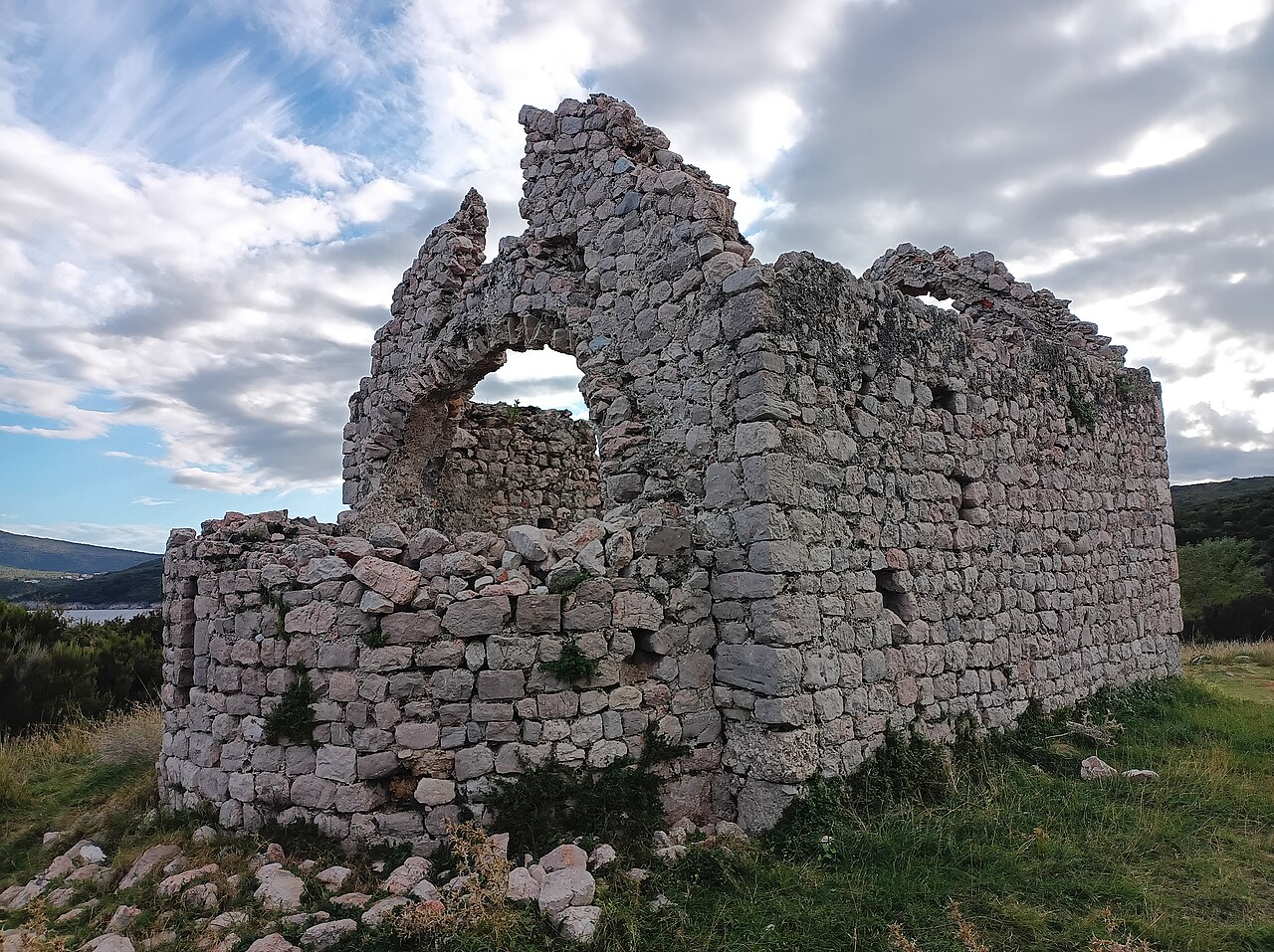
A 14.4 km circular walk (385 m of climbing) north from Vrbnik to the village of Risika, down to Melska cove (pebbles) and Javna cove (pebbles on a sandy seabed), and past the medieval church of St Mark (Sv. Marak), with pine shade in places.
Our tips
- Take swimming things for Melska and Javna halfway round.
- It also works by trekking bike: Vrbnik route 18, Vrbnik - Risika - Sv. Marak - Vrbnik.
Good to know
- 14 km: a half-day, bring water.
- Where
- Vrbnik / Risika
- Season
- Year-round
- Best time
- Spring/autumn; summer mornings
- Getting there
- Start in Vrbnik. Mixed coastal and inland paths, pine sections.
- Start
- Vrbnik (Paid car parks at the edge of Vrbnik, e.g. "Vajavina".)
- Distance
- 14.4 km, round trip, about 385 m of ascent
- Good for
- couples, families with older kids, snorkelling, dogs
- Village guide
- Vrbnik
- Official page
- KRK HIKE 181 - Risika Trail · Biciklističke staze - route 18 Vrbnik - Risika - Sv. Marak - Vrbnik
Open on The Krk Map Directions in Google Maps · Apple Maps
Facts checked 31 Oct 2026
Baška valley easy family ride (Glagolitic letters and the Baška Tablet)
Walk & view · Baška valley
An easy family ride (KRK BIKE 451): 11.3 km and 157 m of climbing on gravel and asphalt from Baška/Zarok to Draga Bašćanska. It passes the Glagolitic letters, Our Lady of Gorica, St Lucy's (Baška Tablet) and the sheep pastures along the Vela Rika.
Our tips
- Kids can collect rubbings of the Glagolitic letters on the way: ask at the tourist office whether the booklet still runs.
- Swim at Vela plaža afterwards.
- Where
- Baška valley
- Season
- Year-round
- Best time
- Mornings; spring/autumn
- Getting there
- Start in Baška centre / Zarok.
- Start
- Baška centre (Atrium Residence trail sign) (Paid car parks in Baška or at Zarok.)
- Distance
- 11.3 km, round trip, about 157 m of ascent
- Good for
- families, kids, e-bike, grandparents
- Official page
- KRK BIKE 451 - Following the traces of Glagolitic heritage and the Baška Tablet · Outdoor - visitbaska.hr
Open on The Krk Map Directions in Google Maps · Apple Maps
Facts checked 31 Oct 2026
Voz peninsula: Vošćica lighthouse and Venetian fort Maltempo
Walk & view · Omišalj - Voz
At the island's northern tip, where Krk comes closest to the mainland, the 1875 Vošćica lighthouse and the ruins of the Venetian fort Maltempo (marked 'Fort of St Mark' on old maps) guard the strait, with a close view of the Krk bridge.
Our tips
- The lighthouse cannot be reached by car: walk down from Voz bay.
- The Byzantine fort on the tiny St Mark islet under the bridge cannot be visited: it is protected.
Good to know
- Bura can be fierce at the strait.
- Don't expect to go inside the lighthouse.
- Where
- Omišalj - Voz
- Season
- Open-air
- Best time
- Late afternoon/sunset for the bridge
- Getting there
- Car to Voz bay, then on foot to the cape.
- Distance
- 1.8 km, about 46 m of ascent
- Good for
- couples, sunset
- Village guide
- Omišalj, Fulfinum-Mirine and Voz bay
Open on The Krk Map Directions in Google Maps · Apple Maps
Facts checked 1 Nov 2026
Curated by Benjamin Haller and our guests · Facts checked 1 Nov 2026 · How this map is made
The Krk Map is made by Marim Luxury Villas, a family company that hosts guests in Stara Baška and Vrbnik. No place pays to be on it; partners and our curators’ own offers are marked. Our villas