What do you want to see?
Walk & view · Baška mountains
Obzova (568 m), Krk's highest peak
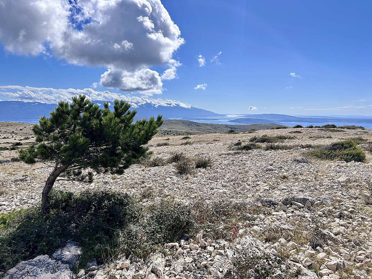
The island's highest point (568 m; stone pyramid with a marble plaque) sits on a bare karst ridge between Punat and Baška. The view runs from Učka and Rijeka bay to Velebit, Cres, Lošinj and Rab. The easiest way up starts from Treskavac pass (319 m): the official loop over Obzova, Brestovica and Veli vrh is 9.4 km with 320 m of climbing (KRK HIKE 145, rated difficult), about 3 h. Steeper ascents start from Draga Bašćanska, Punat and Stara Baška.
Our tips
- Loop order: Treskavac, Žičevo junction, Obzova, Brestovica, Veli vrh (541 m, survey pillar on a stone pyramid), back to the car.
- For less mobile guests: a part-paved road climbs from Treskavac, and driving further up shortens the walk; check whether the road is open to cars. There is also a 2.9 km / 55 min Veli vrh loop from 'Skala'.
- Obzova is control point no. 1 of the Croatian mountaineering circuit (HPO), and there is a stamp (žig) at the summit.
- Pick a slightly overcast day and take at least 2 L of water each.
- The summit has no shade and no shelter from the wind: pack a windproof even in August.
- From Draga Bašćanska you cross smooth slabs with fossils. Add the Kunjalabor lookout over the Baška valley (KRK HIKE 163).
Good to know
- Sharp rock throughout: trainers or boots.
- No water, almost no shade.
- Summit exposed to bura.
The details
- Where
- Between Punat and Baška (Treskavac)
- Season
- Year-round
- Best time
- Spring/autumn. In summer early morning or late afternoon. Winter only without strong bura.
- Getting there
- Treskavac pass on the D102 (Krk-Baška): large gravel car park and trail boards. The steeper climbs start from Draga Bašćanska (7 km, 514 m of climbing), Punat (16.7 km, 630 m, rated difficult) and Stara Baška (12.5 km, 690 m, rated difficult, no springs).
- Start
- Prijevoj Treskavac (Treskavac pass) trail sign, D102 Krk-Baška road (Free car park on the pass, about 500 m from the trail sign (the mapped route starts here), plus a 5-space car park at the sign.)
- Distance
- 9.4 km, round trip, about 320 m of ascent
- Good for
- families, dogs, couples, groups, photography
- Village guide
- Baška mountains: the Moon plateau, Hlam, Obzova and the Glagolitic path
- Official page
- KRK HIKE 145 - The Story Under the Clouds · KRK HIKE 163 - to Obzova and Kunjalabor from Draga Bašćanska
Open on The Krk Map Directions in Google Maps · Apple Maps
Facts checked 31 Oct 2026
Also near here
- Sherry's Honey Store and Mladen Babić Wine & produce · 2.0 km
- Mrgari Sight · 2.6 km
- Vela Rika stream and waterfalls Walk & view · 3.1 km
- Honey Hill Wine & produce · 3.1 km
- Bauxite Story loop Walk & view · 3.3 km
Curated by Benjamin Haller and our guests · Facts checked 31 Oct 2026 · How this map is made
The Krk Map is made by Marim Luxury Villas, a family company that hosts guests in Stara Baška and Vrbnik. No place pays to be on it; partners and our curators’ own offers are marked. Our villas