What do you want to see?
Town · The Krk Map
Omišalj, Fulfinum-Mirine and Voz bay
A clifftop Glagolitic old town above a Roman town on the shore, and a quiet bay under the Krk bridge: an easy stop on arrival or departure day.
Open this guide on The Krk Map
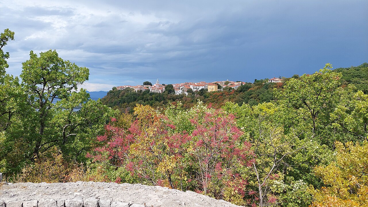
Omišalj sits 80–85 m up on a cliff at the island's northern tip, ten minutes from Rijeka airport. It is a small, real town rather than a resort, with a church square, a Renaissance bell tower and a park of viewpoints over the Kvarner. Below it, the Roman town of Fulfinum and a large 5th-century basilica lie open and free on the shore, and since 2026 they have digital guides in German and English. The industrial backdrop (oil terminal, airport, the bridge road) keeps it from being a full day out from the south of the island, but for a first lunch after landing or a last swim under the bridge before a flight, it is the obvious stop. It suits history-minded couples and families passing through.
When to come: All year. Ulikva open all year. Fulfinum-Mirine is open-air and free. Antički dani Roman evenings in mid-July; Omišaljska rozeta klapa night every 4 August; Stomorina feast 15 August.
What to do
The clifftop old town: Placa, the church, the 1536 bell tower and a Glagolitic door stone
A small, car-free historic centre on the cliff. The parish church of the Assumption (Stomorina) was first mentioned in 1213 and holds a 15th-century triptych by Jacobello del Fiore. Its Renaissance bell tower was built 1533–1536 by master Pjero of Omišalj and master Andrij, paid for by the townspeople and confraternities. It also served as a lookout against Ottoman raids, and its builders recorded the work in a Glagolitic inscription above the entrance. Two lanes away, at Veli Dvor 11, an old door lintel is set low in the house wall: a cross in a medallion and a 1535 Glagolitic inscription for the priest Matija Franović, meant to keep evil out.
- Where
- Placa and the church square at the top of the old town; Veli Dvor 11 for the door stone; Spomen dom krčkog folklora at Prikešte 20.
- When
- Late afternoon, then on to the viewpoints for sunset.
- Time
- 45–60 min
- How
- Park in the paid lots at the edge of the old town (one is paid only in season) and walk in. The heritage signs are bilingual, with QR codes.
Tip: The Spomen dom krčkog folklora (folklore memorial house, Prikešte 20) shows Krk costumes, jewellery and instruments with free entry.
Sunset from the Vele steni viewpoint
The cliff-edge viewpoint at the old town's western rim looks straight down over Omišalj bay to the Fortičina hill-fort ruins and the Roman site of Fulfinum on the shore.
- Where
- Western edge of the old town, a few steps from the church.
- When
- Late afternoon to sunset.
- Time
- 20–30 min
- How
- On foot from Placa.
Tip: Find Fulfinum's basilica outline on the shore from up here first, then go down and walk it; the layout makes more sense after seeing it from above.
Park Dubec: pine paths, stairs down to the sea and a wide view
An 18,000 m² wooded park laid out in 1925 at the end of the old town, with stairs and trails dropping towards the sea. Its viewpoint takes in the Kvarner, Omišalj bay, the villas and hotels built between the two world wars, Cres and the Istrian coast, and the Velebit massif.
- Where
- At the far end of the old town, by the church of St Anthony (Dubec 9).
- When
- Morning or late afternoon; pick a clear day for the long views.
- Time
- 30–60 min
- How
- On foot from the old town; it is also the start of the tourist board's Roman walk and of Camino Krk day 4.
Tip: Use the park as the start of the walk down to Pesja and Fulfinum instead of driving between them.
Walk down to Roman Fulfinum-Mirine and the 5th-century basilica (free)
Roman Fulfinum lies on the shore below Omišalj: forum, baths, a sarcophagus and the big early-Christian basilica of Mirine. Entry is free. Since May 2026 there are interactive info pillars, an 'Infoscope', VR headsets and QR codes in Croatian, English, Italian and German, plus games for children.
- Where
- Mirine, on the shore south-west of Pesja beach; the Fortičina hill fort (open 24/7) stands above Pesja on the way.
- When
- Early evening in summer (little shade), or any time in spring and autumn.
- Time
- 1 hour on site; the tourist-board walk from the old town is 6.7 km (146 m of climbing)
- How
- Walk from Dubec park via Pesja and Sepen, following the tourist board's 'In the footsteps of the Romans' route, or drive to Omišalj bay.
Tip: In mid-July the free Antički dani brings more than 50 costumed actors, gladiator fights and craftspeople to the site in the evening, a good one for families. The dates change each year.
Swim at Pesja, the tree-shaded town beach at the end of the bay
Omišalj's public beach at the end of its 3 km bay, about 1 km from the centre. It is fine pebble and sand with a gentle slope, pine shade, a picnic area, volleyball, step-free sea access and a beach bar, and it is next to the Roman site.
- Where
- End of Omišalj bay, below Fortičina.
- When
- Morning in summer; afternoons are fine in May, June and September.
- Time
- 1–3 hours
- How
- Walk down from the old town or drive to the bay. There are free toilets at the beach.
Tip: Pair it with Fulfinum next door: swim, then walk the Roman site in the cooler early evening.
Voz bay under the Krk bridge, then walk out to the Vošćica lighthouse and the Maltempo fort
Voz is the old ferry harbour below the Krk bridge. It has a 200 m pebble strip that shelves gently, a wide lawn with shade trees behind it, very clear water that divers use and a full view of the bridge; there are no facilities beyond litter bins. A small chapel of St Joseph (1784) stands above the bay. From the bay a path leads to Cape Vošćica, facing the mainland across the narrow Tihi channel. There the Venetians built the Maltempo fort in the late 16th century to control the channel, and a small lighthouse was set into its walls in 1875.
- Where
- Voz is north of Omišalj towards the airport and the bridge; the lighthouse is on Cape Vošćica, east of the bay.
- When
- Late afternoon swim, then the walk to the cape. Bura blows hardest at the strait, so go on a calm day.
- Time
- 2–3 hours with the walk
- How
- A paved road runs all the way down to a parking area at the bay. The lighthouse is reached on foot only, about 1.2 km from the beach as the crow flies; wear proper shoes.
Tip: Stop first at the free car park with a viewpoint on the island side of the bridge, which looks across to Rijeka and Opatija. On the walk out, look back from the end of the bay for the classic bridge shot.
Arrival- or departure-day lunch at Konoba Ulikva by the church
A konoba on the old-town square beside the church, decorated with Omišalj's fishing past, serving fresh local squid and mussels, chard and a cheese dessert. It is open all year.
- Where
- Put Dubca 20, old town.
- When
- Lunch. Open 09:00–20:00 (Fridays to 22:00), so evenings are short outside peak season; check the hours in summer. In April–May ask for the wild-asparagus dishes.
- Time
- 1.5 hours
- How
- Park below the old town and walk up. It is about 10 minutes' drive from Rijeka airport.
Tip: Order the local squid with chard.
Omišalj: a clifftop town, and the tanks are not a refinery
The old town sits high on the cliff. The tanks across the bay are oil storage, not a refinery.
- When
- Late afternoon for the old town
Tip: Visit Omišalj for the old town and the views, not as a beach base.
A half day here
- Arrival day (flight lands around midday): lunch at Ulikva, then the church square, the 1536 bell tower and the Veli Dvor door stone.
- Walk through Park Dubec to the viewpoint and down the stairs towards the sea.
- Swim at Pesja, then walk the Fulfinum-Mirine site with the German or English QR guide.
- Departure-day variant: a morning swim at Voz under the bridge, the walk out to the Vošćica lighthouse, and the bridge viewpoint car park on the way to the airport.
Where to eat and drink
- Konoba Ulikva: Year-round old-town konoba by the church; squid, chard, spring asparagus.
Where to swim
- Pesja: Tree-shaded town beach beside the Roman site.
- Voz bay under the Krk bridge: Clear water, a shady lawn and the bridge overhead: the last swim before a flight.
Practical
Parking
Paid surface lots at the edge of the old town (one is paid only in season). Free parking at Voz and at the bridge viewpoint.
Bakery, shops, pharmacy
Pekara Vrbnik in the centre: Mon–Fri 06:00–19:00, Sat 06:00–13:00, Sun 07:00–13:00. Two convenience shops: Mon–Sat 07:00–20:00, Sun 07:00–12:00. A Lidl is on the road towards the airport, and there is a pharmacy in the centre.
Toilets
Free public toilets at Pesja and in the old town.
Tourist office
Prikešte 13, +385 51 841 042.
Bridge and airport
The bridge has been toll-free since June 2020. Traffic off the island jams on summer Saturdays and Sunday afternoons, and strong bura can close the bridge for a while. Omišalj is the last stop before both.
Watch out
- The oil terminal, the airport and the bridge road shape the views around Omišalj, including the backdrop to Fulfinum.
- Fulfinum has little shade, so visit early evening in summer.
- Bura blows hard at the strait by Voz and Vošćica, so skip the cape walk on bura days.
- The Byzantine fort on the St Mark islet under the bridge is in a protected area and cannot be visited.
- A quarry lies near Voz bay.
Curated by Benjamin Haller and our guests · Facts checked 31 Oct 2026 · How this map is made
The Krk Map is made by Marim Luxury Villas, a family company that hosts guests in Stara Baška and Vrbnik. No place pays to be on it; partners and our curators’ own offers are marked. Our villas