What do you want to see?
Village · The Krk Map
Šilo
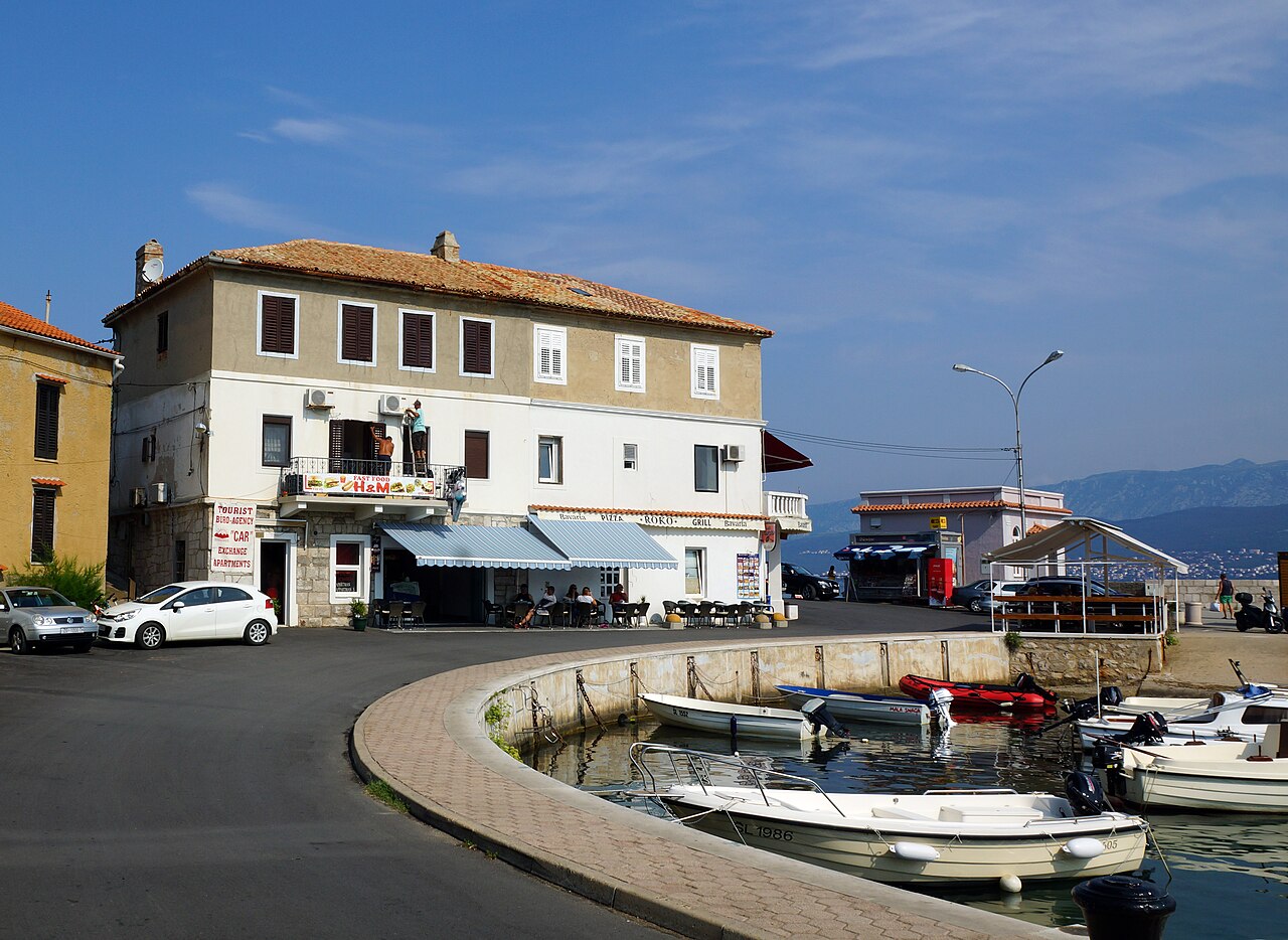
An easy-going harbour resort opposite Crikvenica, with a sand beach, an old tuna lookout on the point and a fast boat to the mainland.
Open this guide on The Krk Map
Šilo is the north-east's everyday resort: a sheltered cove, a promenade of simple restaurants, a sandy family beach and shops with long hours. It is not a place to go for dinner, but it is useful for Vrbnik guests: sand for small children, wild coves south of the village, the Peltastis wreck for divers and a fast boat to Crikvenica for a car-free evening on the mainland. Its story is maritime (a steamship company founded here in 1905, Croatia's first car-ferry line in 1959), and the boards along the harbour tell it.
When to come: Resort season June–September; the Crikvenica boat ran daily in spring and September 2026; St Roch's feast 16 August.
What to do
Read Šilo's harbour story
A row of boards on the harbour tells the village's sea history: the harbour, the sailing fleet, the steamers, the tunera and the ferries, plus the families who founded Šilo. The Krk steamship society was founded here on 19 February 1905 and its steamer 'Dinko Vitezić' opened a Šilo-Vrbnik-Crikvenica line that June; in 1937 the village counted 9 ships. Croatia's first car-ferry line opened here on 12 April 1959, when the wooden ferry 'Bodulka' (room for 12 cars or about 130 passengers) sailed to Crikvenica. The residents built St Nicholas church in 1900.
- Where
- Šilo harbour (riva)
- When
- Any time; evening stroll
- Time
- 30 min
- How
- Park in the paid lots by the centre and walk the harbour.
Tip: Come on 16 August for St Roch's day, the village feast, when the old 'migavica' net-pulling is shown.
Walk out to the tunera on Punta Šilo
On the cape that closes Šilo's cove stands a tunera: a wooden look-out post with a ladder leaning out over the sea, from which fishermen watched for shoals of tuna near the surface. A dog-friendly beach lies right next to it.
- Where
- Punta Šilo, north of the village
- When
- Late afternoon
- Time
- About 45 min to 1 hour return from the harbour
- How
- On foot along the coast from the centre, or park in the small free car park near the cape (10 spaces).
Tip: Bring the dog: the beach right next to the tunera is dog-friendly.
Pećine, the sand beach for small children
Šilo's sandy town beach (Pješčana/Pećine) with a gentle slope and paved sunbathing areas, restaurants alongside and an inflatable aquapark in season.
- Where
- Šilo's town beach, in the centre of the village.
- When
- Mornings in July–August
- Time
- Half a day
- How
- Paid parking in the centre; there is a free public toilet by the beach.
Tip: The easiest sand option for Vrbnik families after Sv. Marak, with more services around it.
The wild coves to the south, and the late-antique fort
South of the village a string of rocky coves opens up: Murvenica (10 min on foot or by gravel road), Jazbina (15 min) and Petrina (30 min). On the way, at the edge of Šilo, stand the ruins of a late-antique fort, also called the Roman villa (Rimska vila), with views over to the mainland.
- Where
- South of Šilo: Murvenica is the first cove; the fort ruins stand at the edge of the village.
- When
- Calm mornings
- Time
- 2–3 hours
- How
- On foot from Šilo, or by car on gravel roads to Murvenica and Petrina.
Tip: Water shoes at Jazbina (sea urchins). Skip Veterna, further south, on bura days: it is very exposed.
Hop over to Crikvenica on the fast boat
A fast passenger catamaran links Šilo with Crikvenica on the mainland daily. The timetable changes through the year: in early September 2026 boats ran about hourly, the last from Šilo at 21:15; from mid-September there were fewer, the last from Crikvenica at 20:00.
- Where
- Šilo harbour
- When
- Evenings in summer for the Crikvenica promenade; any day for a mainland outing without the bridge
- Time
- Half a day or an evening
- How
- Walk on at Šilo harbour; the crossing takes about 10 minutes. Information line +385 99 166 9669.
Tip: Check the last boat back before you go: it changes by the fortnight.
Dive the Peltastis wreck
A Greek freighter that sank in a storm on the night of 7–8 January 1968 lies close to shore between Šilo and Klimno: about 60–70 m long, at a depth of about 15–33 m, with accessible holds. It is an intermediate dive and a classic for Advanced Open Water divers.
- Where
- Off Šilo
- When
- Calm days in the diving season
- Time
- Half a day
- How
- By boat with a dive centre, such as Dive Loft from Vrbnik harbour.
Tip: Certified divers only; visibility drops in current.
A half day here
- 10:00 Pećine with small children, or Murvenica for adults.
- 12:30 A simple lunch on the promenade.
- 15:00 The harbour boards, then the walk out to the tunera on Punta Šilo.
- 17:00 The catamaran to Crikvenica for an evening on its promenade; check the last boat back.
Where to swim
- Pećine sandy beach: Shallow sand beach for small children.
Practical
Shops and bakeries
Šilo's Non Stop Market (daily 07:00–22:00; check before you drive over) is the Sunday fallback when Vrbnik's Market Draga is shut. Two bakeries: 'Pekara', daily 07:00–14:00, and a Pekara Vrbnik summer branch (Mon–Sat 07:00–14:00, Sun 07:00–13:00).
Parking and toilets
Paid lots in the centre; a 27-space lot at Lokvišća beach charges EUR 1/h; a small free lot near the cape. Free public toilet by the sand beach.
Services
Pharmacy, ATMs and a post office (Mon–Fri 08:00–12:00) in the centre. The Šiloturist agency on Na Vodici also runs Biserujka cave.
Watch out
- A resort beach: busy in August.
- Sea urchins at Jazbina; Veterna is exposed to the bura.
- The Peltastis is for certified divers only.
Curated by Benjamin Haller and our guests · Facts checked 31 Oct 2026 · How this map is made
The Krk Map is made by Marim Luxury Villas, a family company that hosts guests in Stara Baška and Vrbnik. No place pays to be on it; partners and our curators’ own offers are marked. Our villas