What do you want to see?
Walk & view · Baška mountains
Diviška pond and peak (Moon plateau extension)
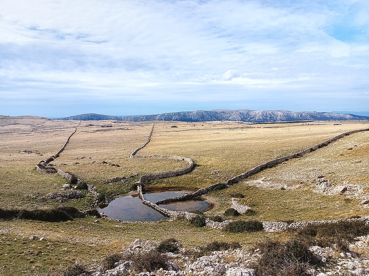
Past the main plateau, a longer out-and-back from Sv. Ivan reaches Diviška pond at about 450 m, a rare water point up here: its drystone walls were built so that five owners' flocks could drink without mixing. The route then climbs Diviška peak (471 m) for views over the Velebit channel and Senj: 12–13.5 km, 3.5–4 h walking (about 5 h with breaks). It is a long day without shade.
Our tips
- The pond is the reason to come: see how the walls divide access between the flocks.
- You are inside the Kuntrep ornithological reserve (protected since 1969): griffon vultures, eagle owl, peregrine falcon, kestrel, ravens.
- Return the same way: the alternative descent via Hlam and Zakam is rough, rocky limestone.
- Strong hikers can link it to Vela and Mala Luka, or do the official 20 km 'Baška's Rocky Challenge' (KRK HIKE 171, 709 m).
Good to know
- No shade for most of the route.
- Carry all your water.
- Steep rocky final climb to the peak.
The details
- Where
- Baška (Draga Bašćanska side of the plateau)
- Season
- Year-round
- Best time
- Spring and autumn. Summer only at dawn. Winter when no strong bura is forecast.
- Getting there
- Start at Sv. Ivan church, Baška. Yellow markings; forest, then macadam and rocky plateau. No shade after the forest. Treat the pond as livestock water, not drinking water.
- Start
- St John's church and cemetery trail sign (Groblje i Crkve Sv. Ivana) (A few street-side spaces by the church, or walk up from Baška.)
- Distance
- 12.5 km, there and back, about 397 m of ascent
- Good for
- couples, groups, birdwatching, photography
- Village guide
- Baška mountains: the Moon plateau, Hlam, Obzova and the Glagolitic path
- Official page
- KRK HIKE 171 - Baška's Rocky Challenge
Open on The Krk Map Directions in Google Maps · Apple Maps
Facts checked 31 Oct 2026
Also near here
- Griffon vultures and raptors Experience · 1.3 km
- Walk to the Moon Walk & view · 2.1 km
- Mala Luka cove restaurant Eat · 2.7 km
- Mala Luka Beach · 2.7 km
- Baška to Vela Luka and Mala Luka coves Walk & view · 3.2 km
Curated by Benjamin Haller and our guests · Facts checked 31 Oct 2026 · How this map is made
The Krk Map is made by Marim Luxury Villas, a family company that hosts guests in Stara Baška and Vrbnik. No place pays to be on it; partners and our curators’ own offers are marked. Our villas